Land Access
Type of resources
Keywords
Publication year
Topics
-
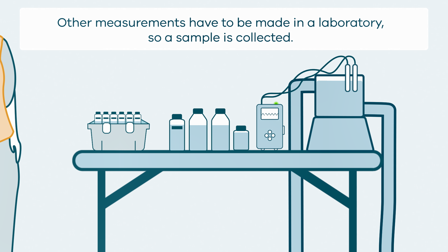
This animation shows how groundwater sampling is conducted. It is part of a series of Field Activity Technique Engagement Animations. The target audience are the communities that are impacted by GA's data acquisition activities. There is no sound or voice over. The 2D animation includes a simplified view of what groundwater sampling equipment looks like, what the equipment measures and how scientists use the data.
-
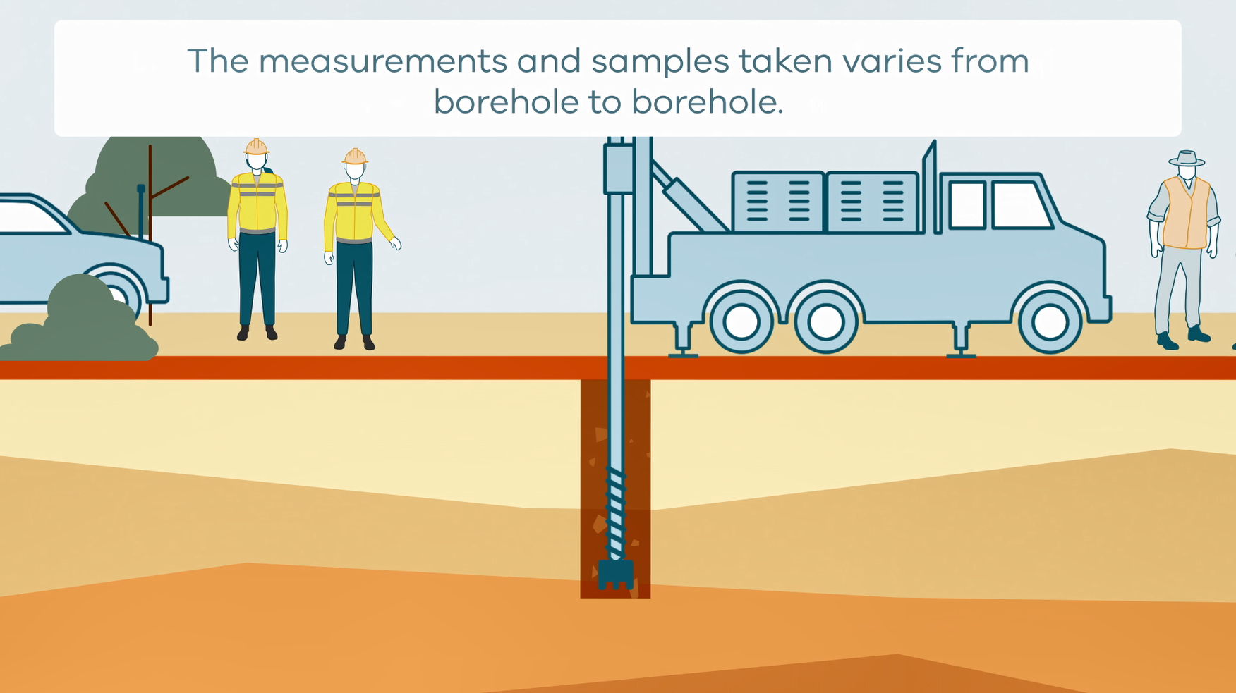
This animation shows how stratigraphic drilling is conducted. It is part of a series of Field Activity Technique Engagement Animations. The target audience are the communities that are impacted by GA's data acquisition activities. There is no sound or voice over. The 2D animation includes a simplified view of what stratigraphic drilling looks like, what measurements and samples are taken, and how scientists use the data.
-
The Land Air Marine Access team have developed a Best Practice Standards approach to land, air and marine access and stakeholder engagement to protect Geoscience Australia's social licence and maximise the benefits of our science outcomes.
-
This collection of documents detail various field techniques and processes that GA conduct. They are in conjunction with a series of Field Activity Technique Engagement Animations. The target audience are the communities that are impacted by our data acquisition activities. Field techniques in this collection include; • AEM fixed wing • AEM Helicopter • Borehole Geophysics • Goundwater sampling • Magnetotelluric (MT) surveys • Passive seismic surveys • Rapid Deployment Kits (RDKs) • Reflection seismic surveys • Surface Magnetic Resonance (SMR) surveys • Stratigraphic drilling
-
A two part Indigenous-led and produced Aboriginal cultural heritage awareness training video for Geoscience Australia staff. The video explores a number of topics from the perspective of Traditional Owners and Custodians. Topics covered include: What is Country, Lore and Kinship; the importance of listening, connecting to Country and the transference of knowledge; Aboriginal cultural heritage legislation and policy in Australia, native title and cultural heritage; the impact of past policies; and, working towards best practice. The video complements Geoscience Australia's Land Access and Cultural Heritage Policy, Procedures and Best Practice Standards.
-
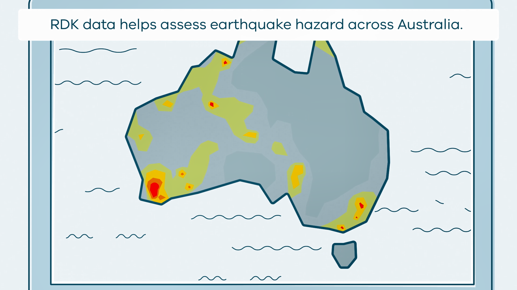
This animation shows what happens when rapid deployment kits (RDKs) are deployed after an earthquake. It is part of a series of Field Activity Technique Engagement Animations. The target audience are the communities that are impacted by GA's data acquisition activities. There is no sound or voice over. The 2D animation includes a simplified view of what rapid deployment kits (RDKs) look like, what is measured, and how scientists use the data.